A clash between Chinese and Philippine Coast Guard ships in the South China Sea on March 5, 2024 1 highlights the increasing pattern of China asserting its territorial claims in the South China Sea, a strategic maritime link connecting the Pacific and Indian Oceans. This region has been at the forefront of international geopolitical discourse due to China’s ever evolving claims and aggressive attempts to flex its dominance in the region. This recent incident should shift our focus to another major event which occurred a few months ago. In September 2023, China unveiled a ‘New Standard Map’ laying claims over territories of multiple neighboring countries including India, Nepal, Bhutan, Japan as well as Russia!
This map also controversially added an extra dash to its existing ‘9 dash line’ a demarcation that extends over 1,500 miles from its mainland and encircles Beijing’s claimed waters and islands of the South China Sea, laying claim to as much as 90% of the sea. China introduced this line for the first time in 1947 which consisted of 11 dashes, two of which were later removed. Ever since its introduction, this line has been a cause of continuous contention among the countries in the South China Sea.
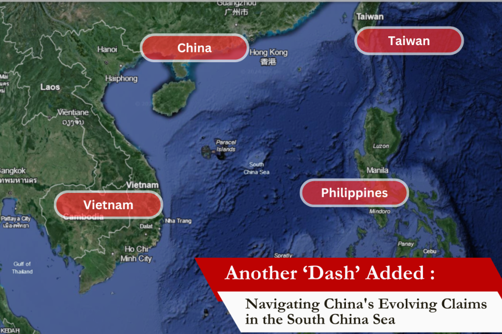
The South China Sea is not only rich in natural resources, including oil and gas reserves, but also a vital commercial shipping route, handling over one-third of global maritime trade, including 55% of India’s trade. The dispute over the South China Sea involving overlapping claims from China, the Philippines, Vietnam, Malaysia, Brunei, and Taiwan is not new. But the addition of a 10th dash further asserts China’s claims, stirring significant international controversy.
Sun Tzu, the legendary Chinese military strategist and philosopher once said, “The supreme art of war is to subdue the enemy without fighting.” This seems to be China’s approach behind these actions, projecting itself as an emerging superpower in the contemporary global order.
The 10-dash line’s assertion directly challenges the sovereignty of the surrounding nations, compelling them to bolster their military presence and seek alliances, thereby escalating regional arms races. This leads to a phenomenon known as ‘Security Dilemma’ in which such an assertive move by a state prompts other states to accumulate arms and increase their security measures eventually leading to a spiral of insecurity between sovereign states. Some scholars of international relations argue that this phenomenon is the most important source of conflict between states. Thus, China’s current move further complicates the already fragile regional security landscape.
China’s expanded claim challenges the core principles of UNCLOS (United Nations Convention on the Law of the Sea), an agreement designed to govern the world’s oceans and seas and ensure the protection of maritime rights. By unilaterally extending its maritime boundaries without adherence to international legal processes, China sets a precarious precedent for maritime sovereignty and law.
The United States and other global powers have expressed concerns over the implications for freedom of navigation, a principle allowing ships to pass through territorial waters without interference. The U.S. Navy regularly conducts ‘freedom of navigation operations’ (FONOPs) through this region, frequently accompanied by India, to challenge China’s excessive maritime claims. This expanded line could thus lead to increased military confrontations, risking international conflict over navigational rights.
Even though the presence of this 10th dash is not new, the re-addition of this dash makes one wonder about the timing, significance and the motive of China in the current geo-political dynamics.
The unveiling of China’s new map has elicited strong reactions from the affected countries, particularly Taiwan around which the 10th dash is added, and the broader international community. Asked about the latest map, Taiwan Foreign Ministry spokesperson Jeff Liu said “Taiwan was absolutely not a part of the People’s Republic of China”. 2
Referring to the South China Sea, Vietnam’s Ministry of Foreign Affairs spokesperson Pham Thu Hang said “Vietnam resolutely rejects any claims in the East Sea by China that are based on the dashed line.” 3
Now, even if we understand that such claims by China doesn’t really change the true sovereignty and territorial integrity of the countries in question, it points to the expansionist mindset and accelerating power ambitions of China. Frontline magazine has called this act of China as ‘Cartographic aggression’ 4 which is true to a large extent as China is using such maps as a tool for projecting its national power. While China seeks to assert its dominance and secure its strategic interests, the move challenges the established norms of international relations and maritime governance.
The Road Ahead :
The future of the South China Sea, a vital artery for international trade and a hotspot for rich natural resources, remains uncertain. The resolution of these disputes requires a delicate balance between national sovereignty, international law, and the maintenance of peace and stability in the region.


It calls for a renewed commitment to diplomatic dialogue, multilateral engagement, and adherence to the principles of UNCLOS. The resolution of the South China Sea disputes will not only shape the future of the region but also define the contours of international maritime governance in the 21st century.
References:
- Gomez, J. (2024, March 5). Philippine and Chinese vessels collide in the disputed South China Sea and 4 Filipino crew are injured. AP News. https://apnews.com/article/philippines-china-south-china-sea-collision-e69d9506e85d1d23685db4f220b50d71#:~:text=MANILA%2C%20Philippines%20(AP)%20%E2%80%94,was%20expected%20to%20be%20 raised
- Taiwan, Malaysia reject China’s latest South China Sea Map. The Indian Express. (2023, September 1). https://indianexpress.com/article/world/taiwan-malaysia-china-late-south-china-sea-map-8919163/
- Ibid
- V., A. (2023, September 28). A map to expansion: Understanding China’s “cartographic aggression.” Frontline. https://frontline.thehindu.com/world-affairs/china-cartographic-aggression-back-to-playing-mind-games-with-maps-claiming-foreign-territories-as-its-own/article67298568.ece
Meet Our Guest Author
Shweta Shah
Assistant Professor (International Relations),
MMCC’s Shankarrao Chavan Law College, Pune.
The views and opinions expressed in this article are those of the author and do
not necessarily reflect the views or positions of Vidhanbharat.


Leave a comment